
Producing Basin
Basin Status
Passive Margin Foreland
Tectonic Setting
0
Area (km2)
0
Visitor Count
0
Likes
Executive Summary
of
Salawati Basin
Description
Version
1
Published Date
24 Jan 2023
Uploaded Date
-
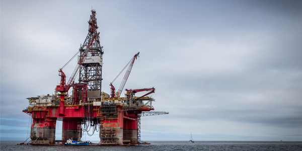
Photos
Some footage of Salawati Basin


Introduction
Preliminary details of Salawati Basin
The Salawati Basin is located in the West Papua region, which is already known as a large oil-producing Tertiary basin in Eastern Indonesia. This basin trending east-west is located at the northern boundary of the Australian continental plate which is moving northward as a passive margin bordering the Pacific Ocean plate which is moving relatively westward and is bounded by the existence of a regional horizontal fault, namely the Sorong Fault. The Salawati Basin develops to the south of the Sorong Fault and the development of the basin is controlled by the movement of this large horizontal fault (Hamilton, 1979)
Data based on:
24 Jan 2023
Exploration History
Detailed history of Salawati Basin
Data based on:
24 Jan 2023
Regional Geology
Detailed regional geology of Salawati Basin
The Salawati Basin is still classified as a relatively young sedimentary basin because it started forming only in the Middle Miocene and the basin began to depression very intensively from the Pliocene to Pleistocene which is assumed to be as a result of the active movement of the Sorong horizontal fault.Based on the stratigraphic, Sorong can be divided into four geological mandalas. From south to north, the mandalas are: Kemum fault, Sorong fault system, Tamrau fault, and Mandala Batanta - Waigeo.
The Kemum includes clastic sedimentary rocks, metamorphic rocks, intrusion rocks, carbonates, and surface deposits which range in age from Silur-Devon to Holocene. The oldest exposed rock is the Kemum Formation (SDk), which consists of slate, phyllite, quartzite, metamorphic sandstone, and metamorphic conglomerate. In outcrop, the formation has been intruded by Lower Melaaurna Karbon (Cm) granite, which may have a relationship with those found in two drill holes in Salawati Island, the other on the mainland of Irian Jaya to the southwest.The two units are unconformably overlain by clastics and altered limestones of the Aifam Group (CPz) which are Upper Carboniferous to Upper Perem, which are overlain unconformably by the incomplete track of the New Guinea Limestone Major Group, which includes the Faumai Limestone (Tef) which Middle Eocene to Upper Eocene, sandstones and mudstones of the Sirga Formation (Toms) which are Upper Oligocene to Lower Miocene and intermarine with carbonates and Miocene limestones Klamogun Limestone and Kais Limestones (Tmkl and Tmka) and Klasafet Formation (Tmk). The Klasafet Formation is overlain by Upper Miocene to Pleistocene siliceous clastic rocks of the Klasaman Formation (TQk). The Pleistocene Sele (Qps) conglomerate and Quaternary alluvium and littoral (Qa) deposits unconformably overlap all older units
Data based on:
24 Jan 2023
Petroleum System
Detailed petroleum system of Salawati Basin
Rocks that can play a role or have the potential to act as source rocks are rocks that contain sufficient organic matter and reach a certain maturity. From the results of several studies, rock formations that have the potential to become source rocks include Sirga Formation, Klasafet Formation, Klasaman Formation, and Pre-Tertiary rocks.The Sirga Formation, according to the results of research conducted by Gadjah Eko Pireno (2008), was deposited in half-graben basins which are thought to develop as lake sediments, so it is assumed to have very abundant organic carbon content and will be a very good source rock. The maturation model shows that the Sirga Formation has entered the final maturation phase, which means it has occurred effectively. In field research, there was no Sirga Formation that appeared as an outcrop, so laboratory analysis could not be carried out to determine its potential as source rock.The Klasafet Formation is thought to be the main source rock of oil or gas produced from the Kais Formation. Members of this formation that have the potential to become source rock are shale which is quite rich in organic material. The problem that arises from the Klasafet Formation is its maturity, which according to the results of research by Gadjah Eko Pireno (2008) and Eddy A. Subroto, et al (1996) shows that it is in an immature phase and only a few relatively deep places are mature.The Klamogun Formation, according to the Regional Geological Map issued by the Center for Geological Research and Development, is not exposed on the surface and is the result of an analysis of subsurface interpretations which also has the potential to become source rock. Based on the results of research by Eddy A. Subroto, et al (1996) and Rudy Phoa & Luki Samuel (1986) showed that the carbonate limestones and shales of this formation contain abundant organic material and show kerogen type II.The Klasaman Formation also has the potential to become a source rock according to the research results of Awang Satyana (2001) the lower part of the Klasaman Formation shows sufficient organic material content. The yield of the TOC is an average of 1.70%. Several oil seeps located on Salawati Island, the results of the geochemical laboratory showed that the oil did not come from the Klasafet or Kais Formations but came from the lower part of the Klasaman Formation (correlated), by facies and maturity is different from oil from the Klasafet/Kais Formation. For the results of laboratory analysis of samples taken when field research is in the process of testing, which is expected to add to the evidence that the Klasaman Formation also has the potential to act as a source rock.The pre-Tertiary rocks that are thought to function as source rocks in the Salawati Basin are the Aifam (Perm), Tipuma (Triassic) and Kemblengan Group (Jura - Kapur) Formations. Generally contain type II kerogen organic material, derived from marine and tends to form petroleum from Pre-Tertiary rock is possible because it has turned into gas or has not yet been discovered because there are no drill holes that have penetrated to the Pre-Tertiary in the Salawati Basin (Subroto, E.A, et al, 1996). In field research, no outcrops have been found showing Pre-Tertiary sedimentary rocks which are part of the Salawati Basin.The well-known formation that acts as a reservoir rock is the Kais Formation. This formation spreads on the surface to the east of Sorong. Kais limestone which has the potential to become a reservoir is part of the reef. This is supported by the discovery of oil seeps (16-AL-13) coming out of the Kais Limestone and laboratory results for measuring porosity at location 16-AL-08/B showing a porosity of 18.27%. The rock that can act as cap rock is the Klasafet Formation shale for the Kais Limestone reservoir. The exposed limestone of the Kais Formation itself can also be a cover for the reef limestone which is the reservoir. For the Pliocene system, the claystone of the Klasaman Formation also has the potential to become a cap rock
Data based on:
24 Jan 2023
Resources
Detailed resources of Salawati Basin
-
Data based on:
24 Jan 2023
Petroleum System Chart
of
Salawati Basin
Description
Version
-
Published Date
-
Uploaded Date
-
Petroleum System Chart
Petroleum system chart to Salawati Basin
Montage
of
Salawati Basin
Description
Version
-
Published Date
-
Uploaded Date
-
Montage
Detailed montage of Salawati Basin
Reports & Publications
of
Salawati Basin
Description
Version
-
Published Date
-
Uploaded Date
-
Reports & Publications PDF
Detailed reports & publications of Salawati Basin
Archives of Report & Publication
| Date | Report Description | Version | Doc | |
| - | No Data | - | - | - |
| Date | Publication Description | Version | Doc | |
| Oct 08, 2022 | Jurnal Cekungan Salawati Tahun 2022 | 1.0 | Download | |
| Oct 09, 2021 | Jurnal Cekungan Salawati Tahun 2021 | 2.0 | Download | |
| Oct 04, 2020 | Jurnal Cekungan Salawati Tahun 2020 | 1.0 | Download | |
| Oct 05, 2019 | Jurnal Cekungan Salawati Tahun 2019 | 1.0 | Download | |
| Oct 05, 2018 | Jurnal Cekungan Salawati Tahun 2018 | 2.0 | Download | |
| Oct 03, 2017 | Jurnal Cekungan Salawati Tahun 2017 | 2.0 | Download | |
| Oct 08, 2016 | Jurnal Cekungan Salawati Tahun 2016 | 2.0 | Download | |
| Oct 01, 2015 | Jurnal Cekungan Salawati Tahun 2015 | 1.0 | Download | |
| Oct 06, 2014 | Jurnal Cekungan Salawati Tahun 2014 | 2.0 | Download | |
| Oct 02, 2013 | Jurnal Cekungan Salawati Tahun 2013 | 1.0 | Download | |
| Oct 04, 2012 | Jurnal Cekungan Salawati Tahun 2012 | 2.0 | Download |