Producing Basin
Basin Status
Passive Margin Deltaic Basin
Tectonic Setting
0
Area (km2)
0
Visitor Count
0
Likes
Executive Summary
of
Tarakan Basin
Description
Version
1
Published Date
20 Jan 2023
Uploaded Date
-
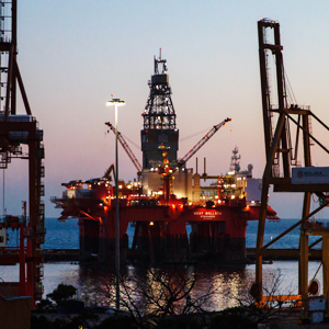
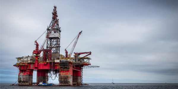
Photos
Some footage of Tarakan Basin


Introduction
Preliminary details of Tarakan Basin
The Tarakan Basin is a Tertiary sedimentary basin which has the following boundaries such as the Cretaceous melange of Central Kalimantan at the western part, to the north by the fold peaks (hinge surfaces) of the Sempura and Peninsula indentations, to the south by the Mangkalihat Peninsula which separates Tarakan Basin with Kutai Basin. Based on the origins, the Tarakan Basin is divided into four sub-basins which namely are Muara sub-basin, Berau sub-basin, Tarakan sub-basin and Tidung sub-basin.
Data based on:
20 Jan 2023
Exploration History
Detailed history of Tarakan Basin
Data based on:
20 Jan 2023
Regional Geology
Detailed regional geology of Tarakan Basin
The tectonic history in the Tarakan Basin can be divided into three main phases such as Eocene–Oligocene syn-rift phase characterized by the formation of horsts and grabens with a general north–south direction, Post-rift Miocene–Pleistocene phase which is characterized by the formation of growth faults, Pliocene Pleistocene uplifting and syn-orogenic uplift phases where inversion occurs and anticline formation occurs. The regional stratigraphy of the Tarakan Basin can be divided into the following phases from Middle Eocene Volcanic Phase that deposition of volcaniclastic and clastic sediments from the Sembakung Formation and Late Eocene–Early Oligocene Depositional Phase of sandstone, claystone, and volcanic rock from the Sujau Formation, deposition of carbonate sediments from the Seilor Formation, and deposition of marl and shale from the Mangkabau Formation, the Middle Oligocene–Middle Miocene Transgression phase which has thin sandstone sediments, tuffs and sandstones of the Tempilan Formation were deposited in the Early Miocene the platform limestones of the Taballar Formation and shales and claystones of the Naintupo Formation were deposited, The depositional phase of the delta environment in the Late Miocene where coarse sandstone, carbonate claystone and limestone inserts of the Meliat Formation, sandstone, claystone and silt of the Tabul Formation were deposited as well as sandstone, claystone and coal inserts of the Santul Formation, Pliocene is the time of form of delta plain deposits that has sandstone, claystone, and thin layers of coal of the Tarakan Formation, The Pleistocene is the phase of the deltaic depositional cycle in which sandstones, conglomerate sandstones and coal of the Bunyu Formation were deposited. The subsurface configuration of the Tanjung Selor region which is included in the Berau Sub-Basin is identified through the gravity anomaly. The play concept in the Tanjung Selor region follows the pattern of forming a hydrocarbon trap in the Tarakan Basin, namely Thrusted anticlinal play associated with the inversion phase in the Plio-Pleistocene, Extensional faulted anticlinal play associated with the formation phase of growth fault, Anticlinal play associated with the formation of intensive growth faulting along the west-east extensive faults in the western part of the offshore area, Oligo-Miocene carbonate play in the transgression phase. In the Sebatik area which is included in the Tarakan Sub-Basin, uplift phase sediments and sediments resulting from Miocene deltaic deposits were exposed, consisting of the Meliat Formation, the Latih Formation and the Tabul Formation. The lower Meliat Formation is dominated by gray argillite with a thin layer of sandy siltstone, greenish-gray in color, the upper part is characterized by glauconitic limestone rich in Nummulites and Alviolina fossils deposited in a shallow marine environment, with an estimated thickness of the formation between 1000 – 2000 m. The Latih Formation consists of quartz sandstone, claystone, siltstone and coal at the top, interspersed with sandy shale, and limestone at the bottom, approximately 800 meters thick, deposited in delta, estuary, to shallow marine environments in Early Miocene to Middle Miocene. The Tabul Formation consists of alternating claystone, mudstone, sandstone, limestone and coal at the top, with a deltaic to shallow marine depositional environment, overlain unconformably by syn-orogenic deposits in a fluviatile environment and littoral swamps from the Labanan Formation, the Domaring Formation, and the Litoral Swamp Formation. Sajau Formation, as well as the volcanic rocks of the Sinjin Formation, are Late Miocene - Pliocene.
Data based on:
20 Jan 2023
Petroleum System
Detailed petroleum system of Tarakan Basin
The results of the analysis of several samples obtained from oil and gas seeps indicate the presence of several origins of organic material, namely from estuarine environments with terrestrial, shallow lacustrine, and deep lacustrine to open marine influences. Oil may be trapped in north-south trending closure structures in the Tarakan sub-basin and northeast-southwest closures in the Tidung sub-basin. These structures are identified through gravity anomaly maps. The play concepts in the Sebatik area follows the pattern of forming a hydrocarbon trap in the Tarakan Basin, namely the inversion phase in the Plio-Pleistocene, Extensional faulted anticlinal play associated with the formation phase of growth faults, Anticlinal play associated with the formation of intensive growth faulting along the west-east extensive faults in the western part of the offshore area, Oligo-Miocene carbonate play in the transgression phase. The lead and prospect of the Sebatik block was created based on the reconstruction of surface stratigraphic measurements and subsurface data from geophysics. Potential source rocks are Mesozoic rocks of the Mentarang Formation and shale of the Sembakung Formation. The potential reservoir rocks are the calcarenite of the Naintupo Formation and the sandstones of the Meliat Formation. While the overburden is the Tabul Formation and fluvial deposits of the Sajau Formation. Recognized hydrocarbon traps are of the thrusted anticlinal play type.
Data based on:
20 Jan 2023
Resources
Detailed resources of Tarakan Basin
-
Data based on:
20 Jan 2023
Petroleum System Chart
of
Tarakan Basin
Description
Version
1
Published Date
20 Jun 2023
Uploaded Date
20 Jun 2023
Petroleum System Chart
Petroleum system chart to Tarakan Basin
Montage
of
Tarakan Basin
Description
Version
1
Published Date
20 Jun 2022
Uploaded Date
20 Jun 2023
Montage
Detailed montage of Tarakan Basin
Reports & Publications
of
Tarakan Basin
Description
Version
1
Published Date
-
Uploaded Date
20 Jul 2023
Reports & Publications PDF
The PDF displayed is only pages 1 to 20. For a complete PDF, you can download it by clicking the download button.
Archives of Report & Publication
| Date | Report Description | Version | Doc | |
| 01 Dec 2016 | Rekomendasi Wilayah Keprospekan Migas Tanjung Selor | 1 | Download PDF |
| Date | Publication Description | Version | Doc | |
| Oct 06, 2022 | Jurnal Cekungan Tarakan Tahun 2022 | 2.0 | Download | |
| Oct 04, 2021 | Jurnal Cekungan Tarakan Tahun 2021 | 2.0 | Download | |
| Oct 04, 2020 | Jurnal Cekungan Tarakan Tahun 2020 | 2.0 | Download | |
| Oct 07, 2019 | Jurnal Cekungan Tarakan Tahun 2019 | 2.0 | Download | |
| Oct 09, 2018 | Jurnal Cekungan Tarakan Tahun 2018 | 2.0 | Download | |
| Oct 02, 2017 | Jurnal Cekungan Tarakan Tahun 2017 | 2.0 | Download | |
| Oct 09, 2016 | Jurnal Cekungan Tarakan Tahun 2016 | 2.0 | Download | |
| Oct 07, 2015 | Jurnal Cekungan Tarakan Tahun 2015 | 1.0 | Download | |
| Oct 03, 2014 | Jurnal Cekungan Tarakan Tahun 2014 | 1.0 | Download | |
| Oct 05, 2013 | Jurnal Cekungan Tarakan Tahun 2013 | 2.0 | Download | |
| Oct 02, 2012 | Jurnal Cekungan Tarakan Tahun 2012 | 2.0 | Download |