Discovery Basin
Basin Status
Rifting Valley Passive Margin
Tectonic Setting
0
Area (km2)
0
Visitor Count
0
Likes
Prospectivity & Resources
of
Taliabu Basin
Basin Capacity
Data based on
29 Mar 2026
Oil
N/A
MMBO
(Million Barrels of Oil)
Gas
N/A
TCF
(Trillion Cubic Feet)
Resources
Data based on
29 Mar 2026
Oil
Conventional N/A
Conventional N/A
MMBO
(Million Barrels of Oil)
Gas
Conventional 4.4
Conventional 4.4
TCF
(Trillion Cubic Feet)
Oil
Unconventional N/A
Unconventional N/A
MMBO
(Million Barrels of Oil)
Gas
Unconventional N/A
Unconventional N/A
TCF
(Trillion Cubic Feet)
Executive Summary
of
Taliabu Basin
Description
Version
1
Published Date
20 Jan 2023
Uploaded Date
-
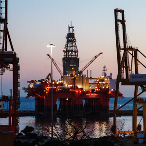
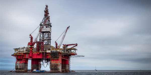
Photos
Some footage of Taliabu Basin


Introduction
Preliminary details of Taliabu Basin
Data based on:
20 Jan 2023
Exploration History
Detailed history of Taliabu Basin
Data based on:
20 Jan 2023
Regional Geology
Detailed regional geology of Taliabu Basin
The Taliabu Basin which is developing in the northern part of Mangole Island and Taliabu, North Maluku Province has quite good hydrocarbon potential with the discovery of many gas seeps in the northern part of Mangole Island. Taliabu Island, which is part of the Banggai-Sula Islands chain, is tectonically included in the Banggai-Sula Zone (Banggai-Sula Terrane in Metcalfe, 1990) or a micro continent (Audley-Charles et al, 1972 also Simanjuntak and Barber, 1996). This is the result of a collision with a subduction system along the eastern boundary of the Sunda Shelf which forms the tectonic framework of Eastern Indonesia (Silver, 1977 and Hamilton, 1979). This island is originate from the northern boundary of the Australian Continent (Klompe, 1954) which separated at the end of the Mesozoic or up to the Paleogene, and was pushed along the Great Sorong Fault caused by the movement of the Philippine Sea Plate (Mc Caffrey et al, 1981). The Sorong Fault in the Sula Islands region is separated into two fault systems, the North Sula Fault and the South Sula Fault in the Banggai-Taliabu-Mangole Islands which are separated from Sanana Island in the south. The shape of Taliabu-Mangole Island characterizes the movement of the Sorong fault which is West - East orientation. Meanwhile, Sanana-Sula Island, which is trending north-south, cuts the two islands in perpendicular shape. Based on Sukamto and Simandjuntak (1983), Pigram et al (1985), Garrard et al (1988), Geological Map of Banggai (Supandjono and Haryono, 1993), Geological Map of Sanana (Surono and Sukarna, 1993), Kusnama (2008), Lelono et al (2011), as well as two drilling wells off the north and west coasts of the Taliabu Islands (Alpha-1 and Loku-1 wells), Mandala Banggai – Sula overlain by metamorphic rock, granite and volcanic rock. The oldest is the metamorphic rock complex (PZm) which consists of schist, genes and quartzite. Then follows the Menanga Formation (Cmm) which is formed from the alternation of crystalline limestones, metamorphic sandstones, slate and phyllite. Radiometric dating indicates the age is Carbon. Both of these units were strongly folded and experienced several times of buffering. The oldest unconformed superimposed unit is the Mangole volcanic rock (TRPmv) which consists of rhyolite, ignimbrite, intervening tuff and breccia. The absolute age of this unit is Permian – Triassic. The metamorphic rocks and the Menanga Formation are intruded by the Banggai granite (TRPbg), which petrologically consists of granite, granodiorite, quartz diorite and pegmatite. Its absolute age is also Permian – Triassic. Above the unconformed overlapping of the Bobong Formation (Jbs) which consists of conglomerates, sandstones, interspersed with shale and coal, it contains local tofu lenses and pyrite bins. This formation is thought to be of Early Jurassic to Middle Jurassic age, the upper part interfingering with the lower Buya (Jb) Formation, which consists of shale, mudstone and calcareous claystone intercalated with fine quartz sandstone and calcarenite. Ammonite and Belemnite fossils indicate Middle Jurassic to Late Jurassic ages. During the Jurassic period there was still magma activity which resulted in breakthroughs and diabase hacking (Da), which broke through the Bobong Formation and the Buya Formation. Above the Buya Formation, it unconformably overlaps the Tanamu Formation (Kt), which consists of Late Cretaceous fossilized marl. The Tanamu Formation is unconformably overlain by the Salodik Formation (Tems), which is in the form of alternating limestone and marl, whose age is Eocene to Middle Miocene unconformably over older units overlapping the Peleng Formation (Qppl) which consists of reef limestones. This formation is Pleistocene to Holocene in age, locally this reef is still growing. The youngest unit in this area is Alluvium (Qa) in the form of river, swamp and beach sediments.
Data based on:
20 Jan 2023
Petroleum System
Detailed petroleum system of Taliabu Basin
Based on the results of field investigations and analysis of secondary data, the Taliabu Basin area can be divided into several ranking areas. The northern part of the island of Mangoleh and Taliabu islands, in this area gas seeps were found, there was a thermogenic HC show from the Drop Core data, there was a hydrocarbon show and proven tested gas in the Loku-1 well data, and there was a closure in the seismic data. Then, The southern and northern parts of the Molucca Sea, in this area only found thermogenic hydrocarbons from the Drop Core data. For the northern part, it is a collision complex, it is very difficult to carry out seismic interpretation because the data is very bad. The western part, Taliabu Platform, this area has at least potential because the existing data, both well data and drop core data, do not prove any indication of HC. Based on the investigation focused on this basin, it can be concluded that the petroleum for this basin are Shale Bobong Formation and Buya Formation as source rock. Reservoirs such as Basement fracture and Sandstone Bobong Formation. Shale Bobong Formation and Buya Formation as seals. Also, this basin has Structural Traps and Stratigraphic Traps. Lead determination is based on the results of seismic interpretation and modeling from depth structure map. In general, the lead is determined based on the presence of closures found on the depth structure map of the Top Bathonian-BBF Eq in the north of Taliabu Island and the Basement elevation in the north of Mangole Island and their distribution in the Taliabu Basin. Volumetric calculation of hydrocarbon resources from each deposit is carried out using the Monte Carlo method. The factors that influence this calculation are net to gross (NTG), porosity, and water saturation (SW) which are obtained from the results of the petrophysical analysis range in Indonesia due to the absence of wells in the study area, as well as the bulk volume value which is calculated based on spill point from each shot. From the results of volumetric calculations, it is known that Gas in place P50 as total resource of P50 is 4.4 TCF.
Data based on:
20 Jan 2023
Resources
Detailed resources of Taliabu Basin
-
Data based on:
20 Jan 2023
Petroleum System Chart
of
Taliabu Basin
Description
Version
-
Published Date
-
Uploaded Date
-
Petroleum System Chart
Petroleum system chart to Taliabu Basin
Montage
of
Taliabu Basin
Description
Version
-
Published Date
-
Uploaded Date
-
Montage
Detailed montage of Taliabu Basin
Reports & Publications
of
Taliabu Basin
Description
Version
1
Published Date
-
Uploaded Date
20 Jul 2023
Reports & Publications PDF
The PDF displayed is only pages 1 to 20. For a complete PDF, you can download it by clicking the download button.
Archives of Report & Publication
| Date | Report Description | Version | Doc | |
| 01 Dec 2021 | Rekomendasi Wilayah Keprospekan Migas Taliabu | 1 | Download PDF |
| Date | Publication Description | Version | Doc | |
| Oct 08, 2022 | Jurnal Cekungan Taliabu Tahun 2022 | 1.0 | Download | |
| Oct 03, 2021 | Jurnal Cekungan Taliabu Tahun 2021 | 2.0 | Download | |
| Oct 08, 2020 | Jurnal Cekungan Taliabu Tahun 2020 | 1.0 | Download | |
| Oct 01, 2019 | Jurnal Cekungan Taliabu Tahun 2019 | 2.0 | Download | |
| Oct 01, 2018 | Jurnal Cekungan Taliabu Tahun 2018 | 2.0 | Download | |
| Oct 03, 2017 | Jurnal Cekungan Taliabu Tahun 2017 | 2.0 | Download | |
| Oct 01, 2016 | Jurnal Cekungan Taliabu Tahun 2016 | 2.0 | Download | |
| Oct 02, 2015 | Jurnal Cekungan Taliabu Tahun 2015 | 2.0 | Download | |
| Oct 01, 2014 | Jurnal Cekungan Taliabu Tahun 2014 | 2.0 | Download | |
| Oct 03, 2013 | Jurnal Cekungan Taliabu Tahun 2013 | 1.0 | Download | |
| Oct 05, 2012 | Jurnal Cekungan Taliabu Tahun 2012 | 2.0 | Download |