Producing Basin
Basin Status
Rifting Valley Back Arc
Tectonic Setting
0
Area (km2)
0
Visitor Count
0
Likes
Executive Summary
of
Sumatera Tengah Basin
Description
Version
1
Published Date
14 Sep 2022
Uploaded Date
-
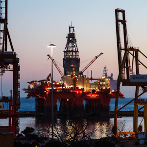
Photos
Some footage of Sumatera Tengah Basin


Introduction
Preliminary details of Sumatera Tengah Basin
According to speculative calculations by the Geological Agency in 2011, the Central Sumatra Basin has a shale gas value of 86.39 TCF. The research location in 2020 is located in the southwestern part of the Central Sumatra Basin which is administratively included in the area of Kuantan Singingi Regency and Indragiri Hulu Regency, Riau Province.
Data based on:
14 Sep 2022
Exploration History
Detailed history of Sumatera Tengah Basin
Oil and gas exploration activities in the Central Sumatra Basin according to BP Migas – LAPI ITB (2008), began with the discovery of hydrocarbon manifestations in the form of oil seeps in anticline structures which then triggered the discovery of the Kampung Oil Field in 1896 (Macgregor, 1995). Oil and gas exploration in the Central Sumatra Basin by PT. Caltex Pacific Indonesia (CPI) started in early 1936, when Standard Oil Company and Texas Oil Company formed a joint venture and named it CALTEX. The first discovery of hydrocarbons was made in 1940 at the Sebanga Gas Field. Then two giant oil fields were discovered, namely the Duri Field in 1941 and the Minas Field in 1944. The Minas Field began production in 1952.Surface geological data were taken in the 2000s and more intensively in 2013 – 2014, then in 2020 only additional field data around Kuantan Singingi Regency.
Data based on:
14 Sep 2022
Regional Geology
Detailed regional geology of Sumatera Tengah Basin
Data based on:
14 Sep 2022
Petroleum System
Detailed petroleum system of Sumatera Tengah Basin
The main target for field data collection is rock outcrops from the Pematang Group. In the research location, it is better known as the Keruh Formation and the Kelesa Formation. All of these target rock formations are the result of syn-rifts at Eocene–Oligocene. The results of Total Organic Carbon (TOC) analysis of the turbidite formation rock samples or equivalent showed values between 0.43 to 18.28 percent of seven rock samples. At the beginning of the study, an inventory was made of 48 wells data around the Kuantan Singingi Regency area, but only 16 wells penetrated the Oligocene to older ages. Then from the 16 wells a re-inventory was carried out which concluded that only 10 wells had wireline logs for petrophysical analysis. The wells are Agha-1, Benai-1, Cenako-1, Gold-1, Parum-17, Silver-1, Bronze-1, Purwo-1, Rabung-1, and WestLyrics-1. The petrophysical analysis carried out included calculations of shale content, porosity, water saturation, total organic carbon (TOC) and brittleness index, using data in the form of wireline logs in LAS format and well reports. The porosity calculation and TOC validation were carried out based on laboratory analysis data on core rock. The data from the petrophysical analysis will then be distributed during the modeling phase. Seismic interpretation and well correlation were carried out to determine the distribution of shale in the Oligocene – Basement, as well as major faults. Then the horizon is processed and linked with the results of geochemical and petrophysical analysis to calculate resource potential. The seismic interpretation results conclude that the Kelesa Formation or equivalent is syn-rift locally. The 3-D model begins by creating a depth structure map, then the geometric modeling is filled with petrophysical parameters such as Vshale, porosity, water saturation, TOC, and brittleness index models. Each model is created with a 150x150 grid. Next is the creation of a sweet spot classification pay zone (shale volume of more than 0.5, TOC of more than 1 percent and a BI value of not less than 0.48), and must pass the oil and gas window. Burial history was also carried out in this study by creating a 1-D model of 10 wells. From the modeling results, it is estimated that none of the 10 wells will enter the gas window maturity. The vitrinite reflectance (Ro) values of all these wells do not exceed 1. Most of the Kelesa Formation in the 10 wells are in the early mature and oil window categories. Sweet spots modeling is made for the oil case. This is because the results have not yet entered the gas maturity window. Sweet spots modeling will get bulk volume values. Then this value is used as the basis for calculating shale oil or original oil in place (OOIP) whose calculation formula is based on research by Marlan W. Downey, et al. (2011) taking into account the value of S1 hydrocarbons. The results of calculating the potential for shale oil in the Kuantan Singingi Sub Basin are 3992.26 MMBO.
Data based on:
14 Sep 2022
Resources
Detailed resources of Sumatera Tengah Basin
-
Data based on:
14 Sep 2022
Petroleum System Chart
of
Sumatera Tengah Basin
Description
Version
1
Published Date
09 Feb 2023
Uploaded Date
20 Jun 2023
Petroleum System Chart
Petroleum system chart to Sumatera Tengah Basin
Montage
of
Sumatera Tengah Basin
Description
Version
1
Published Date
09 Feb 2023
Uploaded Date
-
Montage
Detailed montage of Sumatera Tengah Basin
Reports & Publications
of
Sumatera Tengah Basin
Description
Version
1
Published Date
-
Uploaded Date
20 Jul 2023
Reports & Publications PDF
The PDF displayed is only pages 1 to 20. For a complete PDF, you can download it by clicking the download button.
Archives of Report & Publication
| Date | Report Description | Version | Doc | |
| 01 Nov 2021 | Rekomendasi Wilayah Keprospekan Migas Non Konvensional Sumatera Tengah I | 1 | Download PDF |
| Date | Publication Description | Version | Doc | |
| Oct 07, 2022 | Jurnal Cekungan Sumatera Tengah Tahun 2022 | 2.0 | Download | |
| Oct 09, 2021 | Jurnal Cekungan Sumatera Tengah Tahun 2021 | 2.0 | Download | |
| Oct 01, 2020 | Jurnal Cekungan Sumatera Tengah Tahun 2020 | 2.0 | Download | |
| Oct 02, 2019 | Jurnal Cekungan Sumatera Tengah Tahun 2019 | 2.0 | Download | |
| Oct 08, 2018 | Jurnal Cekungan Sumatera Tengah Tahun 2018 | 2.0 | Download | |
| Oct 04, 2017 | Jurnal Cekungan Sumatera Tengah Tahun 2017 | 1.0 | Download | |
| Oct 09, 2016 | Jurnal Cekungan Sumatera Tengah Tahun 2016 | 1.0 | Download | |
| Oct 04, 2015 | Jurnal Cekungan Sumatera Tengah Tahun 2015 | 2.0 | Download | |
| Oct 01, 2014 | Jurnal Cekungan Sumatera Tengah Tahun 2014 | 1.0 | Download | |
| Oct 04, 2013 | Jurnal Cekungan Sumatera Tengah Tahun 2013 | 2.0 | Download | |
| Oct 05, 2012 | Jurnal Cekungan Sumatera Tengah Tahun 2012 | 2.0 | Download |