Basin with Geology and Geophysics Data
Basin Status
Passive Margin
Tectonic Setting
0
Area (km2)
0
Visitor Count
0
Likes
Executive Summary
of
Singkawang Basin
Description
Version
1
Published Date
20 Jan 2023
Uploaded Date
-
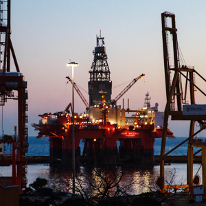
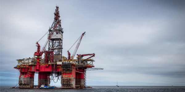
Photos
Some footage of Singkawang Basin


Introduction
Preliminary details of Singkawang Basin
The Singkawang Basin is located in West Kalimantan which is dominated by igneous, metamorphic and sedimentary rocks of Triassic - Jurassic age, Neogene sedimentary rocks deposited in shallow water and there are a few volcanic rocks.
Data based on:
20 Jan 2023
Exploration History
Detailed history of Singkawang Basin
Data based on:
20 Jan 2023
Regional Geology
Detailed regional geology of Singkawang Basin
The geological structure in Singkawang and its surroundings is controlled by a tectonic regime with an East-West trend. In the North, the Crocker-Rajang-Embaluh Cretaceous and Eocene-Miocene accretion complexes are dominated. The complex is composed of turbidite deposits from the debris of Schwaner and younger volcanic arcs deposited in paralic basins to deep ocean trenches. The sediments were imbricated, deformed and lightly metamorphosed during Cretaceous and Tertiary subduction and then intruded into the Oligocene–Miocene Sintang Group after subduction process. The subsurface geological model based on the analysis of gravity data, found that in the study area there are anomalous ridges and anomalous basins generally trending Northwest-Southeast which illustrates the existence of regional structures that have depression in the East-Southwest direction. The subsurface geological model based on 2D seismic analysis found a syncline with a northwest-southeast trending fault structure and unconformity. The syncline structure around the Datuk well has a depocentre with a depth of more than 2500 ft which is composed of five zones of sedimentary rock such as Pliocene to Recent Sandstone, Middle to Late Miocene Shale or Claystone, Early Miocene Sandstone, Oligocene Shale, and Late Cretaceous Metamorphic Rocks. Each of these sedimentary zones is getting thicker towards the depocenter. Even the end pinch out sediment of the Oligocene shale zone is deeper than the other zones so that it cannot be identified in the well.
Data based on:
20 Jan 2023
Petroleum System
Detailed petroleum system of Singkawang Basin
Comprehensive observation of data shows that the physical characteristics of Pliocene-aged surface rocks correlate well with subsurface data as marginal marine sandstones. Accumulation of light fraction hydrocarbons (C1–C2) in almost most of the subsurface rock formations of Ambu-1X and Datuk-1X Wells, while heavy fraction hydrocarbons (C4–C6) were identified only in Datuk-1X Well at a depth of 3000–3500 ft, namely the Early Miocene Sandstone Formation which very porous, with porosity 28-40 percent with an average formation water saturation (Sw) of 56 percent. The Middle to Late Miocene Shale Formation is a very impermeable zone (less than 0.2 percent) overlying very thickly, about 2000 ft. Rock density modeling was carried out based on the primary wave velocity parameter (Vp) using correlations formed empirically by Gardner (Potter, 1998). The study area has four rock groups with varying average rock density values that differ from one another. 2.61 gr per cc Pleistocene to Recent Sandstone, 2.45 gr per cc Middle to Late Miocene Shale, 2.73 gr per cc Early Miocene sandstone, and 3.05 gr per cc Metamorphic Late Cretaceous. Rock characterization to construct subsurface maps using the relationship between rock density and wave velocity. The petroleum system elements from the Datuk-1X Well petrophysics study, especially the rock characteristics of the formations through which the well passes, show that the Early Miocene Shale and Late Miocene Shale have the characteristics of the source rock. Whereas Early Miocene Sandstone based on the physical characteristics of the rock and the fluid that fills the rock pores has the potential to be a reservoir rock. Its role as a caps rock is a very thick Middle to Late Miocene Shale. The results of laboratory analysis of outcrop samples in previous geological and geochemical studies were estimated as source rocks of the prone gas category, namely the Kayan Formation and the Hamisan Formation, which are Eocene to Oligocene in age. This formation is not found in either Datuk-1X Well and Ambu-1X Well. The hydrocarbon trap itself is associated with the half graben structure which was formed during the extension phase in the Late Eocene to Oligocene ages. The formation of traps may be associated with rapid sedimentation after the rifting period in the Miocene and unconformity of sedimentation due to irregular sea level rise effects. Most of the oil and gas fields in the study area are associated with inversion folds of the Miocene age which are bounded by several faults in the rift basin area. Some slopes of the anticline structures are sometimes associated with thrusts and faults. Hydrocarbons formed in synrift lacustrine shales and migrated to sandstone reservoirs of Oligocene to Miocene age, namely the Middle to Upper Miocene Sandstone Formations. The Late Oligocene to Late Miocene Shales are thought to be overburden rocks that are impermeable to fluid flow and overlie most of the reservoir rock. Modeling of hydrocarbon maturity informs that Oligocene-aged sedimentary rocks that extend across the basin floor have a VR more than 2 percent of Ro. This shows that in the research area there is an active petroleum system. Subsurface geological modeling is carried out by integrating seismic data, well logging, laboratory analysis and regional also local geological observations using subsurface geology modeling software. The 3D subsurface geological model framework is built with 9,106 grid cells with a cell size of 300 x 300 ft horizontal. While the facies of the research area are grouped into 4 (four) facies as the results of the formation evaluation. The 3D modeling of rock properties needed in the calculation of oil and gas resource reserves, namely porosity, water saturation, and NTG was built based on petrophysical parameters from well logging data. Water saturation was not modeled due to data limitations. 3D modeling of rock properties is carried out by taking into account the relationship model between seismic attributes such as Acoustic Impedance (AI) and petrophysical parameters of porosity.
Data based on:
20 Jan 2023
Resources
Detailed resources of Singkawang Basin
-
Data based on:
20 Jan 2023
Petroleum System Chart
of
Singkawang Basin
Description
Version
-
Published Date
-
Uploaded Date
-
Petroleum System Chart
Petroleum system chart to Singkawang Basin
Montage
of
Singkawang Basin
Description
Version
1
Published Date
14 Jul 2022
Uploaded Date
-
Montage
Detailed montage of Singkawang Basin
Reports & Publications
of
Singkawang Basin
Description
Version
-
Published Date
-
Uploaded Date
-
Reports & Publications PDF
Detailed reports & publications of Singkawang Basin
Archives of Report & Publication
| Date | Report Description | Version | Doc | |
| - | No Data | - | - | - |
| Date | Publication Description | Version | Doc | |
| Oct 02, 2022 | Jurnal Cekungan Singkawang Tahun 2022 | 1.0 | Download | |
| Oct 07, 2021 | Jurnal Cekungan Singkawang Tahun 2021 | 1.0 | Download | |
| Oct 03, 2020 | Jurnal Cekungan Singkawang Tahun 2020 | 1.0 | Download | |
| Oct 08, 2019 | Jurnal Cekungan Singkawang Tahun 2019 | 2.0 | Download | |
| Oct 02, 2018 | Jurnal Cekungan Singkawang Tahun 2018 | 2.0 | Download | |
| Oct 03, 2017 | Jurnal Cekungan Singkawang Tahun 2017 | 2.0 | Download | |
| Oct 05, 2016 | Jurnal Cekungan Singkawang Tahun 2016 | 2.0 | Download | |
| Oct 09, 2015 | Jurnal Cekungan Singkawang Tahun 2015 | 2.0 | Download | |
| Oct 04, 2014 | Jurnal Cekungan Singkawang Tahun 2014 | 2.0 | Download | |
| Oct 04, 2013 | Jurnal Cekungan Singkawang Tahun 2013 | 1.0 | Download | |
| Oct 05, 2012 | Jurnal Cekungan Singkawang Tahun 2012 | 2.0 | Download |