Producing Basin
Basin Status
Rifting Valley Foreland
Tectonic Setting
0
Area (km2)
0
Visitor Count
0
Likes
Executive Summary
of
Sengkang Basin
Description
Version
1
Published Date
20 Jan 2023
Uploaded Date
-
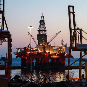
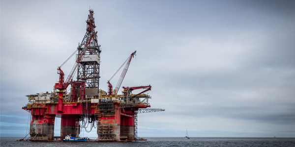
Photos
Some footage of Sengkang Basin


Introduction
Preliminary details of Sengkang Basin
The Enrekang Sub-Basin Investigation was conducted as the northern part of the Sengkang Basin. Tectonically, this area is included in the western mandala. According to Coffield (1993), South Sulawesi is divided into the Latimojong Formation as bedrock (pre-rift sequence), the Toraja Formation (syn-rift sequence), the Enrekang volcanic series (syn magmatic), and the Walanae Formation of the Tacipi Member (syn orogenic).
Data based on:
20 Jan 2023
Exploration History
Detailed history of Sengkang Basin
Data based on:
20 Jan 2023
Regional Geology
Detailed regional geology of Sengkang Basin
From the results of the study, the location of data collect for the Enrekang Sub-Basin were divided into 4 regions, namely Kalumpang, Rantepao, Toraja and Enrekang. The rocks in Kalumpang are dominated by mud flat deposits and a small portion of mixed flat, channel and sand flat deposits. There are also several coal seams in this area. The facies rocks at Rantepao are more dominated by repeated mixed flats, sand flats and mud flats. It generally consists of sandstone, siltstone and claystone which are thinly layered. The rocks from Toraja to Enrekang are shelf deposits in the form of carbonate claystone, dominant in younger deposits and overlapping sandstone facies. The rocks of this location are included in the Toraja Formation and the Makale Formation. The Makale Formation is dominated by packestone-grainstone limestone, relatively turbid, possibly deposited in a backreef environment. The distribution of the Toraja Formation has a southwestern-northeast direction, while the difference in trend patterns is caused by tectonic compression forces.Changes in the depositional environment have a northwest-southeast distribution direction, namely proximal deposits in the northwest (Kalumpang, Mamuju Regency, West Sulawesi Province) and distal deposits in the southeast (Enrekang Regency, South Sulawesi Province).From the observation of thin sections it is known that the rocks in the study area are dominated by limestone, including packstone, wackestone, grainstone and boundstone, and a small portion is arkose arenite.The rocks in the study area were formed from the Eocene to the Miocene with the presence of the Nummulites and Lepidocyclina families. Based on Wilson (1975), the rocks in the study area are formed in the environment of organic build up facies belts, winnowed edge sands and open circulation shelf lagoons.From the analysis of gravity of the Enrekang Sub-Basin, it can be seen that the shape of the Paleogene basin has a long direction northwest-southeast and a wide direction southwest-northeast. This shows that the distribution of the Toraja Formation has a relatively southwest-northeast trend.Seismic analysis has been carried out with the total seismic lines are 247 lines consisting of 3 vintanges, 17 wells used, namely: 1) BBA-1X; 2) Bonge-1; 3) Gilirang A-1x; 4) Kampung Baru North-1, 5) Kampung Baru-1; 6) Kampung Baru-2; 7) Kampung Baru-3; 8) Kampung Baru-4; 9) Kampung Baru-5; 10) Kampung Baru-6; 11) Lamata-1s; 12) Peniki-1; 13) Sallo Bullo-1s; 14) Sampi – Sampi-1; 15) Tironge-1; 16) Walanga-1; and 17) Walanga-2.
Data based on:
20 Jan 2023
Petroleum System
Detailed petroleum system of Sengkang Basin
Based on the results of field investigation, the carbon-rich mudflat deposits from the Toraja Formation have the potential to be hydrocarbon source rocks (confirmed by macro seepage test results). Potential as reservoir rocks are sandflat deposits from the Toraja Formation, the clastic limestones of the Makale Formation. Meanwhile, the marine claystone of the Toraja Formation and limestone of the Makale Formation have the potential to be used as cap rock.From the results of research and interpretation, it can be seen that the concept of each well and the seismic data around it is different and highly dependent on the pattern of geological structure and the developing petroleum system. The concept model in western South Sulawesi shows that most of the accumulation will be driven by the existence of a fault structure pattern. This fault-shearing anticline ridge is a pretty good area.
Data based on:
20 Jan 2023
Resources
Detailed resources of Sengkang Basin
-
Data based on:
20 Jan 2023
Petroleum System Chart
of
Sengkang Basin
Description
Version
-
Published Date
-
Uploaded Date
-
Petroleum System Chart
Petroleum system chart to Sengkang Basin
Montage
of
Sengkang Basin
Description
Version
1
Published Date
20 Jun 2023
Uploaded Date
20 Jun 2023
Montage
Detailed montage of Sengkang Basin
Reports & Publications
of
Sengkang Basin
Description
Version
1
Published Date
-
Uploaded Date
20 Jul 2023
Reports & Publications PDF
The PDF displayed is only pages 1 to 20. For a complete PDF, you can download it by clicking the download button.
Archives of Report & Publication
| Date | Report Description | Version | Doc | |
| 01 Dec 2016 | Rekomendasi Wilayah Keprospekan Migas Enrekang | 1 | Download PDF |
| Date | Publication Description | Version | Doc | |
| Oct 07, 2022 | Jurnal Cekungan Sengkang Tahun 2022 | 1.0 | Download | |
| Oct 05, 2021 | Jurnal Cekungan Sengkang Tahun 2021 | 2.0 | Download | |
| Oct 05, 2020 | Jurnal Cekungan Sengkang Tahun 2020 | 1.0 | Download | |
| Oct 08, 2019 | Jurnal Cekungan Sengkang Tahun 2019 | 2.0 | Download | |
| Oct 03, 2018 | Jurnal Cekungan Sengkang Tahun 2018 | 2.0 | Download | |
| Oct 04, 2017 | Jurnal Cekungan Sengkang Tahun 2017 | 2.0 | Download | |
| Oct 06, 2016 | Jurnal Cekungan Sengkang Tahun 2016 | 1.0 | Download | |
| Oct 09, 2015 | Jurnal Cekungan Sengkang Tahun 2015 | 2.0 | Download | |
| Oct 06, 2014 | Jurnal Cekungan Sengkang Tahun 2014 | 1.0 | Download | |
| Oct 06, 2013 | Jurnal Cekungan Sengkang Tahun 2013 | 1.0 | Download | |
| Oct 03, 2012 | Jurnal Cekungan Sengkang Tahun 2012 | 1.0 | Download |