Discovery Basin
Basin Status
Passive Margin Foreland
Tectonic Setting
0
Area (km2)
0
Visitor Count
0
Likes
Prospectivity & Resources
of
Sahul Basin
Basin Capacity
Data based on
18 Oct 2024
Oil
N/A
MMBO
(Million Barrels of Oil)
Gas
N/A
TCF
(Trillion Cubic Feet)
Resources
Data based on
18 Oct 2024
Oil
Conventional 575
Conventional 575
MMBO
(Million Barrels of Oil)
Gas
Conventional 0.7
Conventional 0.7
TCF
(Trillion Cubic Feet)
Oil
Unconventional N/A
Unconventional N/A
MMBO
(Million Barrels of Oil)
Gas
Unconventional N/A
Unconventional N/A
TCF
(Trillion Cubic Feet)
Executive Summary
of
Sahul Basin
Description
Version
1
Published Date
24 Jan 2023
Uploaded Date
-
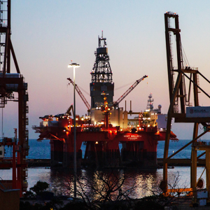
Photos
Some footage of Sahul Basin


Introduction
Preliminary details of Sahul Basin
The Sahul Block is located in the Sahul Basin in Papua Province, which is located south of the Akimeugah Basin, and is part of the Foreland Basin system
Data based on:
24 Jan 2023
Exploration History
Detailed history of Sahul Basin
Data based on:
24 Jan 2023
Regional Geology
Detailed regional geology of Sahul Basin
Data based on:
24 Jan 2023
Petroleum System
Detailed petroleum system of Sahul Basin
The outcrop analogy was taken in the Wamena area where the most complete Papua stratigraphic sequence was found.Papua's tectonic evolution shows that Australia, Papua and PNG originate from the same geological Mandala, so that the oil and gas potential that has been identified in Australia and PNG can be correlated with the Sahul Basin.Following the terminology by the Australian Geological Survey Organization, there are three petroleum systems present in the North Australia Basin namely: Larapintine, with source rock from the early to mid-Palaeozoic marine facies (shales and carbonates), Gondwanan with source rock dominantly Permian terrestrial facies and Westralian with source rock marine Jurassic source rocks. On the basis of this age similarity, the Larapintine petroleum system can be compared with the Pre-Permian Sequence (Otomuna Formation, Tuaba Formation and Modio Formation), the Gondwanan petroleum system can be compared with the Tipuma & Aiduna Sequence while the Westralian petroleum system is compared with the Kembelangan Sequence.From the integration of all existing data, in Sahul there is only one petroleum system, namely the Pre-Permian petroleum system or in Australian terminology it is referred to as the Larapintine petroleum system.The potential source rock in the Sahul Basin is Otomuna Formation shale with a TOC value of 0.2-0.49%. Meanwhile, the potential reservoir in the Sahul Block is a Neoproterozoic marine sandstone. Based on the analysis of the basin modeling it is known that the maturity window has started at the age of 590 ma at a depth of 2000 m.
Data based on:
24 Jan 2023
Resources
Detailed resources of Sahul Basin
-
Data based on:
24 Jan 2023
Petroleum System Chart
of
Sahul Basin
Description
Version
1
Published Date
20 Jun 2023
Uploaded Date
20 Jun 2023
Petroleum System Chart
Petroleum system chart to Sahul Basin
Montage
of
Sahul Basin
Description
Version
-
Published Date
-
Uploaded Date
-
Montage
Detailed montage of Sahul Basin
Reports & Publications
of
Sahul Basin
Description
Version
1
Published Date
-
Uploaded Date
20 Jun 2023
Reports & Publications PDF
The PDF displayed is only pages 1 to 20. For a complete PDF, you can download it by clicking the download button.
Archives of Report & Publication
| Date | Report Description | Version | Doc | |
| 01 Nov 2018 | Rekomendasi Wilayah Keprospekan Migas Sahul | 1 | Download PDF | |
| 01 Dec 2015 | Rekomendasi Wilayah Keprospekan Migas Merauke | 1 | Download PDF |
| Date | Publication Description | Version | Doc | |
| Oct 06, 2022 | Jurnal Cekungan Sahul Tahun 2022 | 1.0 | Download | |
| Oct 04, 2021 | Jurnal Cekungan Sahul Tahun 2021 | 2.0 | Download | |
| Oct 04, 2020 | Jurnal Cekungan Sahul Tahun 2020 | 1.0 | Download | |
| Oct 01, 2019 | Jurnal Cekungan Sahul Tahun 2019 | 2.0 | Download | |
| Oct 04, 2018 | Jurnal Cekungan Sahul Tahun 2018 | 2.0 | Download | |
| Oct 09, 2017 | Jurnal Cekungan Sahul Tahun 2017 | 1.0 | Download | |
| Oct 04, 2016 | Jurnal Cekungan Sahul Tahun 2016 | 2.0 | Download | |
| Oct 07, 2015 | Jurnal Cekungan Sahul Tahun 2015 | 1.0 | Download | |
| Oct 02, 2014 | Jurnal Cekungan Sahul Tahun 2014 | 1.0 | Download | |
| Oct 05, 2013 | Jurnal Cekungan Sahul Tahun 2013 | 2.0 | Download | |
| Oct 01, 2012 | Jurnal Cekungan Sahul Tahun 2012 | 1.0 | Download |