
Discovery Basin
Basin Status
Rifting Valley Passive Margin
Tectonic Setting
0
Area (km2)
0
Visitor Count
0
Likes
Executive Summary
of
Muna - Buton Basin
Description
Version
1
Published Date
20 Jan 2023
Uploaded Date
-
Photos
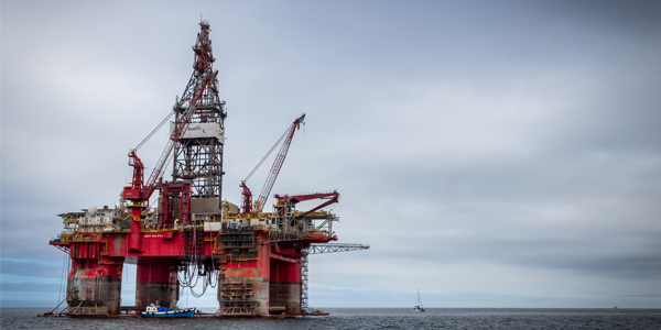
Some footage of Muna - Buton Basin


Introduction
Preliminary details of Muna - Buton Basin
Buton Island is part of the microcontinent that is part of the North Australian Continent. This causes the island's stratigraphy to have similarities with the islands in East Sulawesi (Banggai Sula) and the Banda Arc (Seram Island, Kai, Tanimbar, Timor).
Data based on:
20 Jan 2023
Exploration History
Detailed history of Muna - Buton Basin
Data based on:
20 Jan 2023
Regional Geology
Detailed regional geology of Muna - Buton Basin
Stratigraphy is divided into four tectonic or sedimentological events, Pre-Rift sedimentation, Rift-Drift sedimentation, syn and post orogenic sedimentation, and recent orogenic sedimentation. Hamilton (1979) stated in Davidson (1991) that the Muna-Buton area is composed of two different micro-continent fragments, namely the eastern part of Buton Island and Tukang Besi in the east and the western part of Buton and Muna Island in the west. This seems to be proven by the results of the interpretation of the regional anomaly of gravity map, even though the scope of this research area does not extend to Tukang Besi. The western part is strongly influenced by continental crust (granitic) while the eastern part is strongly affected by the composition of the banda sea crust (basaltic). In relation to the pattern of the existence of sedimentary basins, based on this study it is shown that there are several interesting depocenters (sub-basins) and elevations. The distribution of the sedimentary sub-basins and elevations is somewhat different from that stated by Davidson (1991).
Data based on:
20 Jan 2023
Petroleum System
Detailed petroleum system of Muna - Buton Basin
Based on the three exploration wells, namely Sampolaka-1S, Bulu-1S and Bale-1S, all three were discovered empty or dry even though there were indications of hydrocarbons. Based on the regional gravity anomaly map, the positions of the Sampolaka-1S and Bulu-1S wells are in a strong suture zone so that the hydrocarbons are not trapped. While the Bale-1S well is on the edge of the depocenter. Based on the interpretation of the gravity anomaly map, the remaining possible traps/structures that are more interesting are in the southern part of Muna Island and southwest of Buton, the east-central coast of Muna Island to the north and west of Ereke, which used to be called the Lambele Sub-basin. Oil seeps, gas seeps and asphalt are very abundant on Buton Island. Asphalt is widespread in North Buton and South Buton. Gas seeps are located on Wawoni Island, North Buton and Central Buton. The gas is biogenic. Oil seeps were found in Nunu Village (Central Buton) and South Buton. On Muna and Wawoni Islands, there were no indications of hydrocarbons. The results of the GC analysis of the Nunu oil seep showed that the chromatogram had undergone biodegradation. All the alkanes and their isoprenoids have been lost for consumption by aerobic bacteria. It is estimated that the Nunu oilseepage sample has undergone biodegradation with a level of 4-5 (moderate). Gas seepage is very common in North Buton. Its characteristics are associated with hot springs adjacent to shear faults. Asphalt in Buton is controlled by structures and is located near or on reactivated Miocene faults or Pliocene-Pleistocene faults, especially in the South Buton area. Based on geochemical analysis, the types of oil in Buton are divided into two that are Mesozoic and Cenozoic oils. In the research area, at the North Buton region, the source rock is carbonate marine shale of the Late Triassic Winto Formation, which has been shown to correlate with several hydrocarbon seeps that appeared on Buton Island. In addition, the Miocene Shale of the Tondo Formation has the potential to become host rock in this area, which is proven to correlate with Nunu oil seeps that are present in the Buton fault line. Reservoir potential in this area comes from limestone of the Tobelo Formation of Cretaceous – Paleogene age, sandstones and limestones of the Tondo Formation of Miocene age, and sandstones of the Trias – Jurassic age of the Meluhu Formation. In addition, there is potential for the Kapantoreh fractured ophiolite, which can be found close to the west along the Buton fault. Structural traps are generally in the form of 3-way dip and 4-way dip associated with up faults and folds. Structural traps were generally formed in the Late Miocene. In North Buton, structural traps are associated with the fold-thrust belt. Stratigraphic traps can be found in the Tondo Formation (Miocene), in the form of changes in limestone facies with claystone.
Data based on:
20 Jan 2023
Resources
Detailed resources of Muna - Buton Basin
-
Data based on:
20 Jan 2023
Petroleum System Chart
of
Muna - Buton Basin
Description
Version
1
Published Date
20 Jun 2023
Uploaded Date
20 Jun 2023
Petroleum System Chart
Petroleum system chart to Muna - Buton Basin
Montage
of
Muna - Buton Basin
Description
Version
-
Published Date
-
Uploaded Date
-
Montage
Detailed montage of Muna - Buton Basin
Reports & Publications
of
Muna - Buton Basin
Description
Version
1
Published Date
-
Uploaded Date
20 Jul 2023
Reports & Publications PDF
The PDF displayed is only pages 1 to 20. For a complete PDF, you can download it by clicking the download button.
Archives of Report & Publication
| Date | Report Description | Version | Doc | |
| 01 Nov 2021 | Rekomendasi Wilayah Keprospekan Migas Buton | 1 | Download PDF |
| Date | Publication Description | Version | Doc | |
| Oct 06, 2022 | Jurnal Cekungan Muna - Buton Tahun 2022 | 1.0 | Download | |
| Oct 06, 2021 | Jurnal Cekungan Muna - Buton Tahun 2021 | 1.0 | Download | |
| Oct 07, 2020 | Jurnal Cekungan Muna - Buton Tahun 2020 | 2.0 | Download | |
| Oct 04, 2019 | Jurnal Cekungan Muna - Buton Tahun 2019 | 2.0 | Download | |
| Oct 09, 2018 | Jurnal Cekungan Muna - Buton Tahun 2018 | 2.0 | Download | |
| Oct 02, 2017 | Jurnal Cekungan Muna - Buton Tahun 2017 | 2.0 | Download | |
| Oct 05, 2016 | Jurnal Cekungan Muna - Buton Tahun 2016 | 2.0 | Download | |
| Oct 08, 2015 | Jurnal Cekungan Muna - Buton Tahun 2015 | 1.0 | Download | |
| Oct 04, 2014 | Jurnal Cekungan Muna - Buton Tahun 2014 | 1.0 | Download | |
| Oct 09, 2013 | Jurnal Cekungan Muna - Buton Tahun 2013 | 2.0 | Download | |
| Oct 06, 2012 | Jurnal Cekungan Muna - Buton Tahun 2012 | 1.0 | Download |