Prospect Basin with Proven Petroleum System
Basin Status
Passive Margin
Tectonic Setting
0
Area (km2)
0
Visitor Count
0
Likes
Prospectivity & Resources
of
Arafura Basin
Basin Capacity
Data based on
18 Oct 2024
Oil
N/A
MMBO
(Million Barrels of Oil)
Gas
N/A
TCF
(Trillion Cubic Feet)
Resources
Data based on
18 Oct 2024
Oil
Conventional 6144.54
Conventional 6144.54
MMBO
(Million Barrels of Oil)
Gas
Conventional 7.36
Conventional 7.36
TCF
(Trillion Cubic Feet)
Oil
Unconventional N/A
Unconventional N/A
MMBO
(Million Barrels of Oil)
Gas
Unconventional N/A
Unconventional N/A
TCF
(Trillion Cubic Feet)
Executive Summary
of
Arafura Basin
Description
Version
1
Published Date
24 Jan 2023
Uploaded Date
-
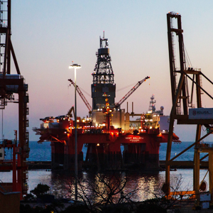
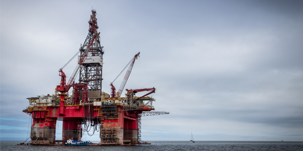
Photos
Some footage of Arafura Basin


Introduction
Preliminary details of Arafura Basin
The location of this study is in the south of Papua Island, to be precise in the southwest of the city of Merauke.
Data based on:
24 Jan 2023
Exploration History
Detailed history of Arafura Basin
Data based on:
24 Jan 2023
Regional Geology
Detailed regional geology of Arafura Basin
This study uses seismic data acquired by the Geological Agency in 2017, other seismic data, and three drilled well data. There are three drilling wells in the research area, namely the E-1X, E-2X, and E-3X wells. The status of these three wells is a dry hole with plugged and abandoned. Therefore, this study uses the newly acquired data to reveal other types of play that have the potential to trap hydrocarbons.The stratigraphy of the study area was obtained from the correlation of the three exploration wells. Starting from the rocks of Pre-Cambrian, Upper Paleozoic, Triassic, Cretaceous and Miocene. The first analysis to be carried out is the seismic interpretation of the results of the binding of the E-2X well and the ARSEL_06 line. The oldest rock is the intrusive sill which is estimated to be 748 mya. Above these rocks are Permian age rocks obtained from the seismic cross section on the right side of the ARSEL-06 line. The Permian age rocks are overwritten by Cretaceous rocks, namely Aptian and Albian ages. This Cretaceous age rock begins with Lowstand Cretaceous sandstone, on the left it is continued by Aptian Prograding Shoreface, transgressive marine, and regressive. The Cretaceous rocks are covered by Miocene rocks.
Data based on:
24 Jan 2023
Petroleum System
Detailed petroleum system of Arafura Basin
Based on the results of the seismic facies interpretation, two potential reservoirs were found in the study area, namely the Aptian Prograding Shoreface and the Permian Fluvio-Deltaic Lacustrine pinchout play. Volumetric calculations were performed on both plays, and the volumes were 3242.32 MMBO for the oil case and 3884 TCF for the gas case for the Aptian Prograding Shoreface play and 2902.25 MMBO for the oil case and 3.4 TCF for the gas case for the Permian Fluvio-Deltaic Lacustrine pinchout play.Geochemical analysis was carried out to determine the potential of source rock in the study area, geochemical analysis showed that the potential source rock in the research area is Paleozoic age rock, as seen from the vitrinite reflectance curve which has passed the number 0.6 and also this Paleozoic age rock has a transformation ratio value. However, it is hoped that rocks that are younger than Permian age rocks can also become source rocks in deeper parts
Data based on:
24 Jan 2023
Resources
Detailed resources of Arafura Basin
-
Data based on:
24 Jan 2023
Petroleum System Chart
of
Arafura Basin
Description
Version
1
Published Date
20 Jun 2023
Uploaded Date
20 Jun 2023
Petroleum System Chart
Petroleum system chart to Arafura Basin
Montage
of
Arafura Basin
Description
Version
-
Published Date
-
Uploaded Date
-
Montage
Detailed montage of Arafura Basin
Reports & Publications
of
Arafura Basin
Description
Version
1
Published Date
-
Uploaded Date
20 Jul 2023
Reports & Publications PDF
The PDF displayed is only pages 1 to 20. For a complete PDF, you can download it by clicking the download button.
Archives of Report & Publication
| Date | Report Description | Version | Doc | |
| 01 Nov 2019 | Rekomendasi Wilayah Keprospekan Migas Merauke Offshore | 1 | Download PDF |
| Date | Publication Description | Version | Doc | |
| Oct 06, 2022 | Jurnal Cekungan Arafura Tahun 2022 | 1.0 | Download | |
| Oct 07, 2021 | Jurnal Cekungan Arafura Tahun 2021 | 2.0 | Download | |
| Oct 02, 2020 | Jurnal Cekungan Arafura Tahun 2020 | 2.0 | Download | |
| Oct 09, 2019 | Jurnal Cekungan Arafura Tahun 2019 | 2.0 | Download | |
| Oct 09, 2018 | Jurnal Cekungan Arafura Tahun 2018 | 2.0 | Download | |
| Oct 08, 2017 | Jurnal Cekungan Arafura Tahun 2017 | 1.0 | Download | |
| Oct 01, 2016 | Jurnal Cekungan Arafura Tahun 2016 | 2.0 | Download | |
| Oct 03, 2015 | Jurnal Cekungan Arafura Tahun 2015 | 2.0 | Download | |
| Oct 08, 2014 | Jurnal Cekungan Arafura Tahun 2014 | 1.0 | Download | |
| Oct 09, 2013 | Jurnal Cekungan Arafura Tahun 2013 | 1.0 | Download | |
| Oct 08, 2012 | Jurnal Cekungan Arafura Tahun 2012 | 1.0 | Download |